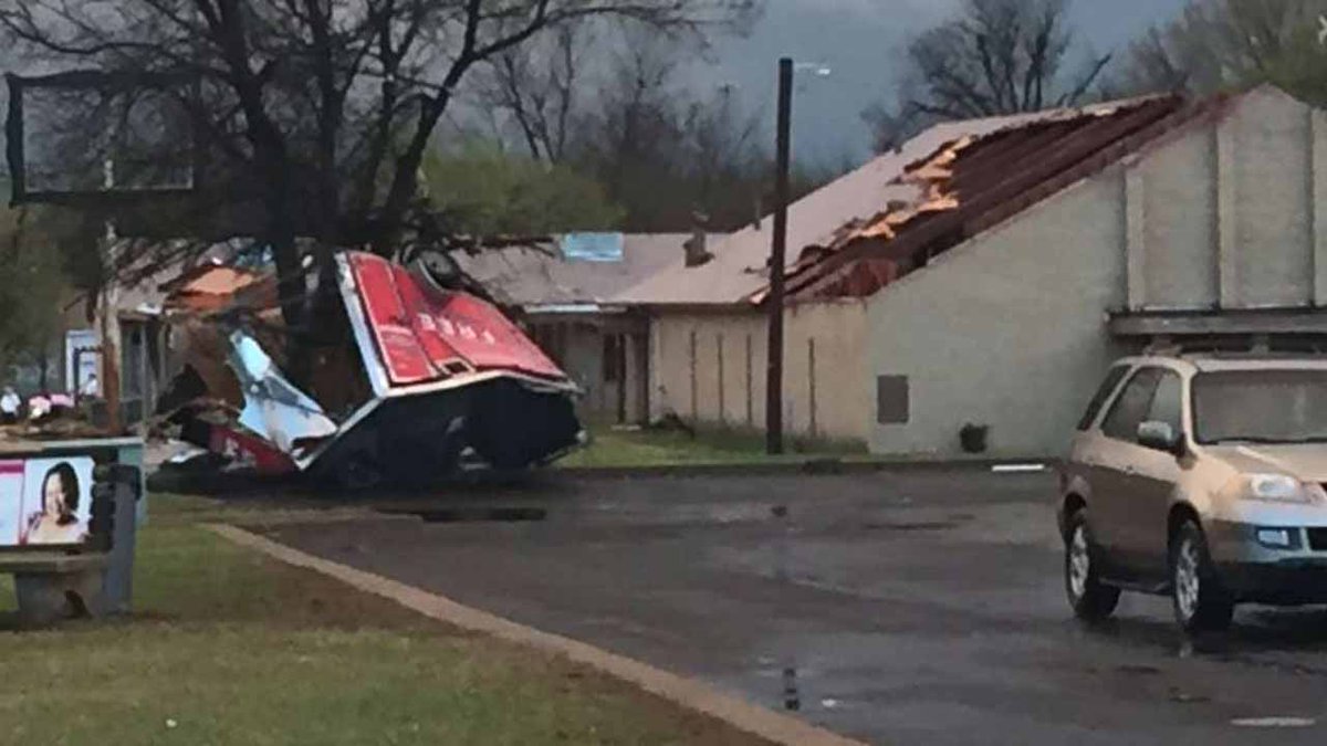
Severe thunderstorms, large hail and tornadoes are affecting the central United States since Wednesday, March 30, 2016. The worst weather today is expected in Mississippi, Alabama, Tennessee and Kentucky as a large front, extending from the Great Lakes to the Southern Plains, slowly moves to the East Coast.
There were 6 tornado and 77 large hail reports on March 30. Four tornadoes were reported in Oklahoma, one in Kansas and one in Arkansas.
Hail the size of golf balls was reported near Wichita, Kansas while tennis ball-sized hail pounded Breckenridge, Texas.
At least 9 people have been injured in Oklahoma as a result of the severe storms.
"Weather-related calls resulted in 9 patients transported so far tonight. Most calls were for serious injuries & one critical patient," EMSA said on their Twitter account.
A family of four escaped serious injury after a tree fell on their truck during a tornado in North Tulsa, police said.
Schools in Tulsa will be closed on Thursday due to power outages and storm damage.
Supercell that passed just north of Tulsa this evening… photo by Ashleigh Webb #okwx
Funnel Touches Down In North Tulsa, Damages Church, Power Lines http://bit.ly/1V7vkd0
NWS Little Rock said a record rainfall occurred in North Little Rock, Arkansas. "100.6 mm (3.96 inches) of rain at North Little Rock so far today. It's the wettest March day on record (since 1975) beating the old record 88.4 mm (3.48 inches) 3/7/1990."
By the end of the day, 125.5 mm (4.94 inches) of rain fell in North Little Rock breaking the all-time March 30 record set in 2002 with 43.4 mm (1.71 inches).
The University of Arkansas at Little Rock was forced to close its campus due to flooding.
In Greene County, Missouri a house fire was started by a lightning strike 6.4 km (4 miles) east of Springfield.

NWS Radar Mosaic - 07:58 UTC on March 31, 2016.
According to SPC, severe thunderstorms are possible across a large area extending from the central Gulf Coast states northward across the Ohio Valley to southern Michigan on March 31.
The greatest threat of tornadoes and very large hail will be centered over northern Mississippi and Alabama into Tennessee and southern Kentucky.
More isolated severe storms are possible during the evening into the western Carolinas and Friday morning, April 1, along the central Gulf Coast.

Featured image: Featured image: Tornado that hit Owasso, Oklahoma on March 30, 2016. Credit: KWTV-News 9 (CBS)
Credit to BBC
 James Spann

No comments:
Post a Comment