
11:00 p.m. (and final) update: On his Twitter feed, Al Roker posted that Greg Forbes, the Weather Channel’s severe weather expert, said today’s outbreak might be the largest on record in March. It will be a few days before the full extent of this outbreak has been assessed. 94 tornado reports have been logged today, but there may be some double counting. The record for the largest March outbreak is 74 from March 11-13, 2006.
Today’s death toll is now at least 28 (12 in Kentucky, 14 in Indiana, and 2 in Ohio). The National Weather Service has issued 269 tornado and 335 severe thunderstorm warnings (see remarkable map). Surely, without these warnings, the death toll would be much higher. NWS deserves much credit for its timely and accurate warnings today.
At the moment, the only active tornado warnings are in north central Georgia and east central Alabama. From this point forward, the region from south central Mississippi through western South Carolina probably has the highest chance of severe weather. Thunderstorms further north - responsible for the balance of today’s tornado outbreak - have been steadily weakening.
10:00 p.m. update: The Weather Channel is now reporting 27 fatalities from today’s outbreak. 11 are dead in Kentucky according to WKYT. (14 died in Indiana and 2 in Ohio).
While some thunderstorms are weakening as they work closer to the Appalachians, a number of tornado warnings continue in eastern Tennessee, southwest Virginia and northern Georgia and Alabama.
An incredible 77 tornado reports have been filed today.
Links: latest tornado warnings | Storm reports today

Tornado probabilities into the night within 25 miles of any point as of 7:30 p.m. Via Storm Prediction Center.9:00 p.m. update: Multiple fatalities are now being reported out of West Liberty, Kentucky where a violent tornado appears to have hit earlier this evening. Tornado warnings continue tonight from far southwest Virginia and off to the southwest, including one in the northern suburbs of Atlanta, Ga.
8:00 p.m. update: As storms begin to run into the Appalachians, more than a dozen tornado warnings are active from West Virginia through eastern Kentucky and Tennessee, then down into the Gulf Coast states. The threat is expected to last into the night, particularly in the southeast U.S. where a large area of high tornado potential still exists.
Up to eight people are now reported killed by the storms across southern Indiana, and numbers in the region are likely to grow. The Kentucky National Guard is moving into the town of West Liberty where reports of a mass casualty event have come in.
If you’re looking for tornado videos from today, check out this compilation.

A tornadic storm bears down on West Liberty, Ky. earlier this evening where multiple casualties are now being reported. Radar image via Stu Ostro.6:55 p.m. update: The state ofKentucky has been placed under a state of emergency as storms that have destroyed several small towns in southern Indiana shift east. In the last hour, over 20 additional tornado warnings have been issued and we’re now closing in on 200 tornado warnings on the day with 67 reports of tornadoes on the ground. Both numbers continue to climb as tornadic storms impact areas from eastern Ohio to Mississippi and Alabama. If most of the tornadoes that were reported today are confirmed, this outbreak is well placed to surpass the previous March calendar day record of 59.
Of particular concern are a number of radar signatures, like the one shown in this loop of an apparently mass casualty causing storm in Kentucky, indicating debris being picked up near the southern end of the hook (where the tornado is). In the coming period, eastern Kentucky and into eastern Tennessee (Chattanooga in central Tn. faced its second tornado warning of the day recently) are under the gun for the most intense storms, but supercells capable of producing tornadoes continue in a line to the south and east.

Tornado watches cover a large chunk of the Tennessee and Ohio Valleys, and the South. (NOAA SPC)
5:55 p.m. update: A mind-boggling number (26) of tornado warnings continue, with a large concentrationin central and eastern Kentucky into southern Ohio. As darkness approaches, the tornado danger grows due to difficulty in spotting them (and verifying those seen on radar).
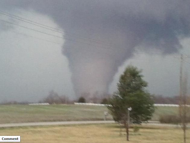
There have been 53 tornado reports so far today. Here is a frighteningimage of the tornado that destroyed the town of Henryville, Indiana. And another image showing the aftermath.

5:30 p.m. update: CNN Weather reports there are presently 22 active tornado warnings and 5 tornado watches, covering 5 states.
5:25 p.m. update: Nick Walker of the Weather Channel (@wxdude on Twitter) reports golf ball sized hail and damage to building roofs in Nashville as tornadic thunderstorm came through.
5:15 p.m. update: As we await word on the situation in Nashville, a tornado warning is in effect for Bowling Green, Kentucky through 5:45 ET.
More bad news out of Indiana: in addition to the town of Marysville, the town of Henryville was also destroyed by a tornado earlier today.

Radar shows tornadic thunderstorm approaching south side of Nashille at 4:55 p.m. ET (3:55 CT) . (Wunderground.com)5:00 p.m. update: Nashville faces a very dangerous situation as a thunderstorm with a history of producing tornadoes and large hail bears down. A tornado warning continues there. Damage has been been reported just to the west of Nashville in Dickson.
In southern Indiana, state police report at least 6 people died from the earlier twisters. Photos from town of Marysville, Indiana largely wiped out.
4:40 p.m. update: Tornado warning now out for Nashville, Tennessee until 4:15 p.m. local time (5:15 p.m. eastern time).
4:30 p.m. update: Tornadic thunderstorms continue to batter southeast Indiana, northern and western Kentucky, and parts of Tennessee and northern Alabama and Mississippi. There have been 37 reported tornadoes so far today, 104 tornado warnings issued and 214 severe weather reports.
Tornadic thunderstorms are currently positioned south of both Cincinnati and Louisville. Even though these storms may miss these urban centers, southern suburbs may take a hard hit.
Another thunderstorm capable of producing a tornado is about 30 minutes to the west of Nashville, moving in that general direction.
Meanwhile, a new particularly dangerous situation tornado watch has been issued for eastern Kentucky, southeast Ohio, and western and central West Virginia until midnight.
4:05 p.m. update: The Associated Press reporting 1 town - Marysville - “gone” amidst extreme tornado damage in southern Indiana.
3:50 p.m. update: The tornado report count is up to 31 and tornado warnings are currently in effect in 8 states.
A high school in Henryville, Indiana was struck by a tornado, and severely damaged. A twitter report indicates 30 people trapped.
3:25 p.m. update: The situation in southern Indiana (see 2:55 p.m. update below) is dire. CNN reports there are 2 large, destructive tornadoes on ground along I-65 northwest of Louisville, KY. Both Louisville and Cincinnati, OH need to very carefully track these storms.
Indiana towns of Nabb, Henryville, and New Pekin have been hit hard according to reports.
There have been 26 reports of tornadoes so far today.

Radar at 2:51 p.m. in western Kentucky and southern Indiana. Red polygons indicate tornado warnings in effect at that time.2:55 p.m. update: The radar imagein southern Indiana stretching into extreme western Kentucky is extraordinarily ominous. A train of rotating, supercell thunderstorms have developed, with seven tornado warnings currently in that region. These storms are generally northwest of Louisville and northeast of Paducah.
2:25 p.m. update: The tornado outbreak continues. Since 10 a.m. this morning, the National Weather Service has issued 51 tornado warnings (source:@stormchaster4850).
Another tornado watch has been issued for northeast Mississippi, northern Alabama, and western and central Tennessee through 9 p.m. local time.
Reports from Twitter and the National Weather Service indicate significant damage occurred from a tornado in Posey County, Indiana.
Meanwhile, more pictures are coming in from the damage from the tornado in northern Alabama this morning. Slideshow.
At the moment tornado warnings are in effect in five states: Illinois, Indiana, Tennessee, Kentucky, and North Carolina
1:05 p.m. update: A new particularly dangerous situation tornado watch has been issued for central and southern Indiana, central and eastern Kentucky, and southwest Ohio through 9 p.m. local time. It includes the cities of Dayton, Cincinnati, Columbus, Louisville, Lexington, and Bowling Green
To the west, a tornado and/or funnel cloud was spotted southwest of Cape Girardeau in southeast Missouri. It should pass between Scott City and Cape Girardeau. Watch live stream. The tornado warning for that area expires at 1:45 p.m. (ET, 12:45 p.m. CT).
In Tennessee, Twitter reports indicate significant damage from a possible tornado in the Chattanooga area near Island Cove Marina
The tornado that ripped through northern Alabama earlier, not far from Huntsville, destroyed several homes according to reports. It also damaged a correctional facility.

A large area of the eastern U.S. is under a slight, moderate, or high risk of severe thunderstorms today. (NOAA SPC)11:35 a.m. update: High severe thunderstorm risk area (described below) has been expanded to include southwest Ohio and more of southern Indiana (see graphic to right).Additional areas may soon be under tornado watches. Also,major/significant damage has been reported in the Huntsville, Alabama area from a tornadothat swept through the region.
OVERVIEW OF SITUATION(from 10:40 a.m.): NOAA’s Storm Prediction Center (SPC) has placed portions of Tennessee, Kentucky and extreme south central Indiana under a “high risk” of severe thunderstorms today. The “high risk” designation is reserved for the most dire severe weather situations, and used only a few times a year on average.
Notably, a particularly dangerous situation tornado watch has been issued for central and southern Illinois, central and southern Indiana, western Kentucky, and southeast Missouri until 6 p.m. local time. “Destructive” and “significant” tornadoes are possible in this area.
A tornado watch has been issued for northern Alabama, northwest Georgia, and middle and eastern Tennessee through 3 p.m. Tornado warnings have already been issued across northern Alabama and east Tennessee with at least one report of a tornado on the ground.
“Long-track, strong tornadoes” are possible today, especially in the high risk zone. Areas under a moderate and slight risk of severe thunderstorms also have significantly elevated potential for violent weather. The severe storm risk covers approximately 56% of the U.S. and affects 162 million people according to NOAA.
Here’s an excerpt from SPC’s statement on the storm threat:
THE MORE SERIOUS SEVERE STORM/TORNADO RISK WILL BEGIN TO MATERIALIZE IMMEDIATELY EAST OF THE MISSISSIPPI RIVER BY MIDDAY. A BROKEN BAND OF STORMS WILL LIKELY FORM ALONG THE COLD FRONT BY EARLY AFTERNOON ... WITH ADDITIONAL STORM DEVELOPMENT EXPECTED FARTHER EAST
THE VERY STRONG VERTICAL SHEAR...MODERATE INSTABILITY ... A MOIST LOW-LEVEL ENVIRONMENT ... ALL APPEAR SUPPORTIVE OF A POTENTIALLY SIGNIFICANT TORNADO EPISODE WITH A FEW LONG-TRACK/STRONG TORNADOES. THE MOST PROBABLE AREA FOR DAMAGING TORNADOES WILL BE NEAR AND SOUTH OF THE OH IORIVER FROM EXTREME SOUTHERN INDIANA INTO CENTRAL KENTUCKY AND MIDDLE TENNESSEE
The Weather Channel’s severe weather expert Greg Forbes has raised itsTOR:CON index to a 9 out of a possible 10 in parts of Tennessee and Kentucky. This means there is a very high probability of tornadoes in this region. Forbes said: “I would expect to see dozens of tornadoes in a frenzied afternoon.”

Significant tornado parameter values greater than 1 are bounded by the dashed red line. The highest levels span from northern Alabama through southern Indiana. (NOAA SPC)SPC’s tornado assessment indicates there is as high as 30% chance of a tornado occurring within 25 miles of any given point within the high risk area. Some of these tornadoes may reach EF-2 intensity or higher.
One of the tools forecasters use to assess tornado potential, known as the Significant Tornado Parameter (STP), shows extraordinarily high values in the high risk area. NOAA’s SPC notes “a majority of significant tornadoes (F2 or greater damage) have been associated with STP values greater than 1”.
In addition to the tornado threat, the probabilities for destructive non-tornado winds and large hail are very high at around 45%, covering a large portion of the Ohio and Tennessee Valleys.
Cities that may be affected by this potential outbreak include:
Tupelo, Tuscaloosa, Birmingham, Huntsville, Nashville, Evansville, Louisville, Bowling Green, Cincinnati, Indianapolis and Columbus.
Last night, the National Weather Service Office in Nashville warned the following:
[THIS EVENT MAY BE] THE BIGGEST OUTBREAK OF TORNADOES SINCE APRIL 27, 2011. THIS EVENT COULD BE ONE OF THE GREATER IMPACT EVENTS IN THE PAST FEW YEARS. THE PUBLIC SHOULD BE STRONGLY ADVISED TO TAKE THIS THREAT VERY SERIOUSLY.
Washington Post
No comments:
Post a Comment